Integrated Vessel Tracking

What is the purpose of the Integrated Vessel Tracking DeST?

The Integrated Vessel Tracking (IVT) DeST serves as a cornerstone of South Africa's maritime security and environmental protection strategies. The system's sovereign architecture ensures data security and operational autonomy, empowering South Africa to take full control of its maritime domain. Moreover, IVT DeST promotes coherence and continuity in safeguarding South Africa's valuable marine resources, fostering a sustainable and secure maritime future for the nation.

This DeST is only available to authorised users.

Mobirise Website Builder

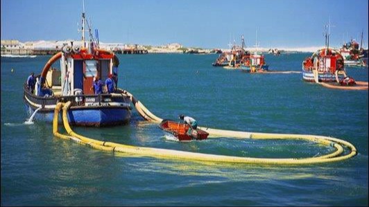
Hout Bay Harbour, Cape Town (Image: Unsplashed)

Why? 

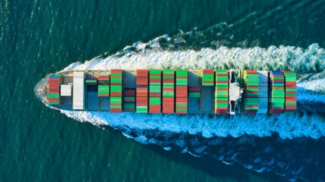
The surveillance of territorial sea areas holds increasing significance for coastal nations. According to the United Nations Convention on the Law of the Sea (UNCLOS), countries can establish a territorial sea extending up to 12 nautical miles from their coastline and an Exclusive Economic Zone (EEZ) of up to 200 nautical miles. These zones become crucial economic resources for coastal states, entailing responsibilities for administration, law enforcement, environmental protection, and sustainable management. South Africa, as a maritime nation, has its security and economy intricately tied to the safe passage of vessels through its vast EEZ, which ranks among the world's largest. To safeguard this vital maritime domain, the National OCIMS Integrated Vessel Tracking Decision Support Tool (IVT DeST) has been implemented to ensure effective vessel traffic monitoring that intelligently monitor ships and pollution in near-real time to provide this information directly to users. 

Benefits

Mobirise Website Builder
Economic: Managing Limited Resources for Sustainable Governance of Ocean Environments

IVT DeST optimises the utilisation of marine resources by providing real-time insights into vessel movements and activities. This data-driven approach enables informed decision-making, ensuring the sustainable management of South Africa's maritime domain for the benefit of both present and future generations.

Mobirise Website Builder
Environmental impact: Protecting Sensitive Marine Habitats and Species

By providing comprehensive vessel traffic data, authorities are empowered to identify and proactively protect sensitive marine ecosystems and endangered species. This helps mitigate the negative impacts of human activities on the marine environment, preserving South Africa's rich marine biodiversity.

Mobirise Website Builder
Safety and security: Enhancing Coordination for Effective Enforcement

IVT DeST fosters seamless collaboration among maritime stakeholders, enabling a unified approach to monitoring and enforcing maritime regulations. This bolsters South Africa's ability to combat illegal activities, safeguarding the country's maritime interests and resources.

Technical info

To establish a comprehensive overview of vessel movements within South Africa’s extensive EEZ, the Integrated Vessel Tracking Decision Support Tool (IVT DeST) harnesses the power of multiple data streams, fusing information from remote sensing technologies and transponder-based systems. This innovative approach offers several distinct advantages:

01.

Amplified Coverage and Visibility

Remote Sensing Data from Satellites: Synthetic Aperture Radar (SAR) imagery, with its ability to penetrate clouds and operate day or night, provides independent surveillance of vast maritime areas, even in challenging weather conditions. This ensures continuous monitoring of vessel activity, regardless of external factors.

Transponder Data: Automatic Identification System (AIS) signals, broadcast by vessels themselves, offer real-time information on their location, identity, and voyage details.

Vessel Monitoring Systems (VMS): Often used for fisheries management, provide additional tracking capabilities for specific fishing vessels. 

02.

Enhanced Data Integrity and Reliability

The integration of these complementary datasets safeguards against potential gaps or blind spots in either system.

Remote sensing can detect vessels that may not be transmitting AIS signals (known as “Dark Targets”), whether due to intentional non-compliance or system malfunctions.

Conversely, AIS and VMS data can validate and enrich the information gleaned from remote sensing imagery, providing more detailed vessel identification and activity patterns. 

03.

Sophisticated Data Fusion and Analytics

IVT DeST integrates and analyses these diverse data streams, generating a unified and comprehensive view of vessel traffic within South Africa’s EEZ.

Advanced algorithms and techniques enable the identification and tracking of vessels, even those attempting to evade detection.

This fusion of multiple datasets provides a more robust and reliable foundation for maritime decision-making, supporting a wide range of applications such as:
   o Enforcement of maritime regulations
   o Protection of marine habitats and species
   o Sustainable governance of ocean        resources
   o Search and rescue operations 

04.

Optimised Resource Allocation and Response

By pinpointing vessels of interest and identifying potential threats, IVT DeST empowers South African authorities to strategically allocate limited resources for enforcement and conservation efforts.

This targeted approach maximises the effectiveness of maritime operations, ensuring timely and efficient responses to emerging challenges. 

Data contributors

Government departments

Department of Forestry, Fisheries and the Environment, Defense Intelligence, South African Navy Hydrographic Office

Parastatals and entities

Council for Scientific and Industrial Research, South African Weather Services, South African Environmental Observation Network, South African Maritime Safety Association, Transnet National Port Authority, Institute for Maritime Technology, South African National Space Agency

Frequently asked questions

  • Is the IVT system available to the public?
    No, the IVT system is not directly available to the general public. Due to the sensitive nature of the data it collects, access is restricted to authorised users such as government departments (e.g., law enforcement and security agencies) and approved stakeholders. This ensures that the data is used for legitimate purposes and in compliance with international regulations.
  • How do I get access to the IVT system?
    To request access to the IVT system, please send a formal letter to the OCIMS email address. The letter should include your details, company/department details, and a clear explanation of your intended use of the system. The letter must be on company/department letterhead and signed by a senior manager who can authorise your access.
  • How do I request or contribute data to the IVT system?
    If you have a need to request or contribute data to the IVT system, please follow the same procedure as outlined above. Send a formal letter to the OCIMS email address, providing your details, company/department details, a description of the data you require or wish to contribute, and the purpose of using or providing the data. The letter must be on company/department letterhead and signed by a senior manager who can authorise your request or contribution.
  • What types of data does the IVT system collect?
    The IVT system collects a variety of data from multiple sources, including: 1) Remote sensing data: This includes data from satellites, such as radar/optical imagery and Automatic Identification System (AIS) signals. 2) Transponder data: This includes data from vessels themselves, such as AIS signals and Long Range Identification and Tracking (LRIT) signals. 3) Other data sources: This includes data from shore-based stations, such as coastal radars.
  • How is the data collected by the IVT system used?
    The data collected by the IVT system is used for a variety of purposes, including: 1) Monitoring maritime traffic: The system helps authorities track the movement of vessels in South Africa's Exclusive Economic Zone (EEZ). 2) Enforcing maritime regulations: The system helps authorities identify and investigate potential violations of maritime regulations, such as illegal fishing and smuggling. 3) Protecting sensitive marine habitats and species: The system helps authorities identify and protect sensitive marine areas and endangered species. 4) Responding to emergencies: The system provides authorities with real-time information that can be used to respond to emergencies, such as search and rescue operations and oil spills.
  • How does the IVT system protect privacy?
    The IVT system takes a number of measures to protect privacy, including: 1) Limiting access to data: Access to data is restricted to authorised users, and data is not shared publicly. 2) Aggregating data: Data is often aggregated to protect the privacy of individual vessels. 3) De-identifying data: Personal information is removed from data whenever possible. 4) The IVT system is committed to protecting the privacy of individuals while also providing the information needed to safeguard South Africa's maritime domain.
Mobirise Website Builder

© Copyright 2024 DFFE. All Rights Reserved.

Best AI Website Creator