Water Quality

What is the purpose of the Water Quality DeST?

The purpose of the Water Quality Decision Support Tool (DeST) is to provide support to coastal managers’ decision making processes by providing a consolidated view of various remote-sensed and in-situ sources of water quality data. It is also expected that scientists and researchers will want to contribute and would need access to consolidated and integrated datasets that allow for understanding of historical conditions and comparison with other, relevant datasets.

In-situ data is typically gathered by government, municipalities, Non-Government Organisations (NGOs) and research organisations in support of various objectives. For example, the DFFE monitors water quality at various locations, the Wildlife and Environment Society of South Africa (WESSA) monitors beaches to see if they comply with Blue Flag requirements, local municipalities monitor beaches, bays and harbours to ensure water is safe for usage, NGOs monitor areas of interest to ensure that their environment is being safeguarded for the public.

Please feel free to contact us if you are interested in joining the Water Quality Technical Advisory Group (TAG) or if you have any suggestions for improvement.

Mobirise Website Builder

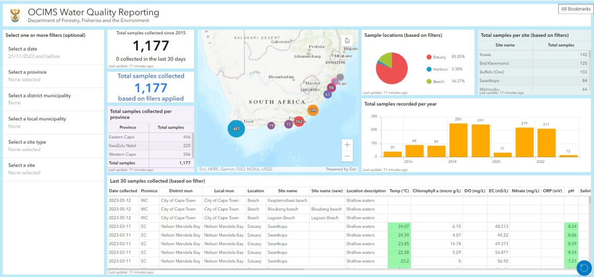
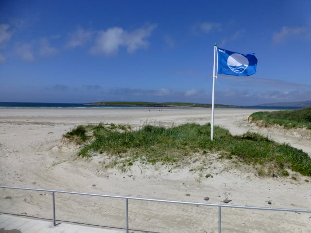
Beach with Blue Flag status (Source: WESSA, 2019)

How?

Recently, ocean colour satellites have become available with appropriate resolution for near coastal observations. These satellites can provide remote sensed data every few days applicable to a wide range of coastal phenomena, including gross water quality parameters. They can therefore support the detection of substantial changes to aspects of coastal ecosystems over time and space.

Processed satellite imagery is used in the Water Quality DeST to provide information on the concentration of phytoplankton as given by the pigment chlorophyll a, the turbidity of the water due to suspended sediment or discharged particles, and the presence of any unusual discharge material causing surface discolouration e.g. industrial effluent. Satellites are not able to directly detect bacterial pathogens, heavy metals or other water quality parameters that do not cause a colour change.

The two satellite constellations relevant to water quality are the Sentinel 2 series, providing products at 10 m to 60 m resolution every five days and the Sentinel 3 series, providing products at ±300 m resolution every day. The satellite data, acquired from the European Space Agency (ESA) and the European Organisation for Meteorological Satellites (EUMETSAT), are processed by the CSIR using regionally appropriate algorithms. 

Contributors

  1. European Space Agency (ESA) and the European Organisation for Meteorological Satellites (EUMETSAT)
    Sentinel 2 series, providing products at 10 m to 60 m resolution every five days and the Sentinel 3 series, providing products at ±300 m resolution every day.
Mobirise Website Builder

© Copyright 2024 DFFE. All Rights Reserved.

No Code Website Builder